Mid-August of 2022 hubby Trevor and I took a leap of faith and completed the Tchaikazan River, over Spectrum Pass, Around Dorothy Lake, and through Yohetta Valley loop. It would turn out to be one of our favorite trips, and so-called “honeymoon.” This blog is a trip log, which may prove useful for those interested in doing their own trip, or just want to live vicariously through the photos. As usual we “iNatted” our whole trip, better known as documenting nature, and then later uploading our observations to the citizen science platform, iNaturalist.
This trip took place on the Tŝilhqot’in Nen land.
Wednesday
We left Pemberton around 5am, reaching Williams Lake around 10am-ish. After grabbing some groceries and an early lunch we made it to the Nemaiah gas station around 1:30pm. We weren’t too sure if the gas station would even be open, and we needed it to be because the trailhead was quite a ways away still.
After gassing up we stopped in at the welcome center, and talked to two ladies who were very helpful. One lovely lady told us that a portion of our route was cut out (yipeeeeee), and alternative hikes if we decide to ditch our plans. We were also told of the potential of the gate around 3km to be closed, as the First Nation band is planning to close it in order to restrict hunting in the area. They are asking hunters with LEH moose tags to stay home.


After much thanks were said we drove to the trailhead, which took a long time, about 2 hours. The road was fine for our Subaru Forester, just a bit bumpy, long and windy, and one lane-y. We turned right along a small road along the airstrip. We weren’t sure how far we wanted to drive, because we’d have to walk to our car at the end of the hike. But a good-sized sinkhole was caused by a creek running under the road. Decision made! Parked our car at: 51.20078, -123.65562.
We only met one car on road and talked to folks who said the Tzechizan trail was terribly overgrown and swampy, they only made it halfway up to the alpine towards Spectrum pass, and turned around because the bushwhack was too bad. Hmmmm. They didn’t recommend the hike even though it was a beautiful valley. Hmmmmm. Okayyyyyy. Not exactly what we wanted to hear as we were packing our gear.
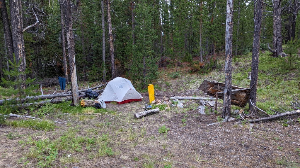
We decided to still go with the plan and started walking around 5pm along the road, which eventually became an ATV trail, and then a small trail, and made camp around 630pm (51.16644, -123.67606) on an embankment along a bend in the river. A small black bear was terribly startled by us right before camp, and it wouldn’t be the only close encounter with a bear.

Thursday
We were up at 4am, and out of camp by 6am. The trail does have a few windfall/bug-killed trees bisecting it, and it was more overgrown with dwarf birch/buckbrush. Definitely not as terrible as the folks we ran into on the road in. We only lost the trail a few times.
Around 10am we decided to stay on the sand bar for a bit, this was just past the cowboy camp. When exploring the sand bar for plants and bugs Trevor looked up to see a massive Grizzly absolutely tromping his way away from us. Kaboom Kaboom Kaboom. Gone. The bear must have also been startled by our presence and barreled away.
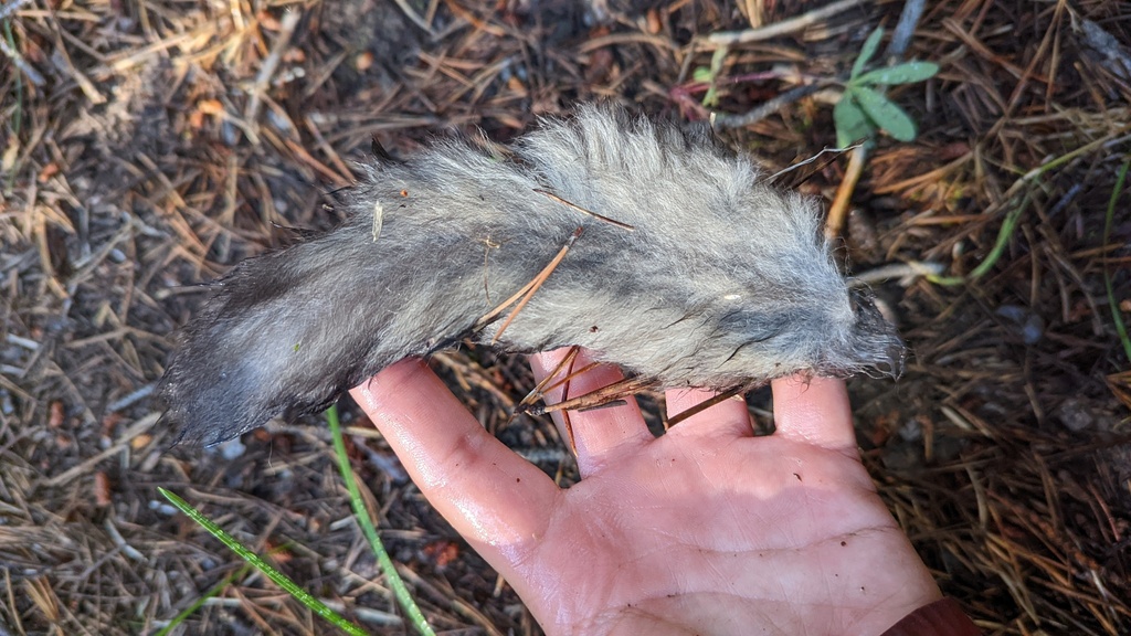
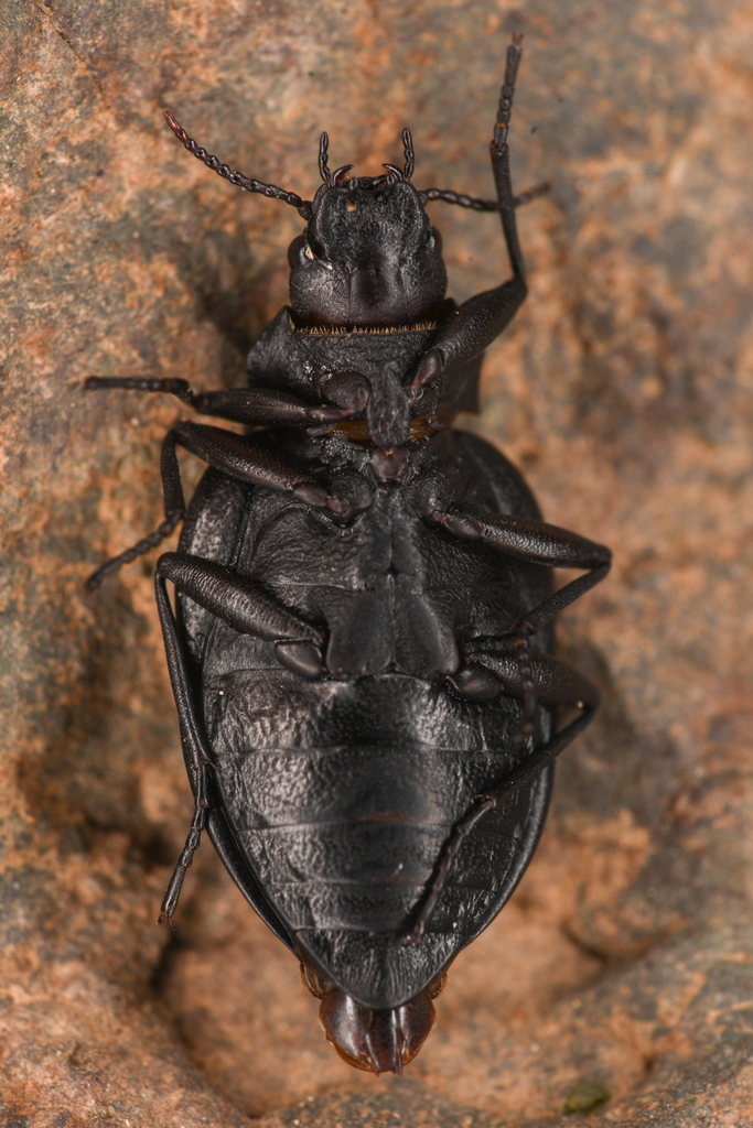
I stepped over several of these tails while on this loop, especially in this stretch, and couldn’t figure out who it belonged to! But thanks to iNaturalist, this fluffy tail belongs to a Northern Flying Squirrel Glaucomys sabrinus! How cool! I mean. . . I’d much rather see one alive, but at least I know there’s a healthy population on this trial! Evidence of presence, like this tail, is just another way to connect with nature that you’d otherwise never know where in the vicinity. Just like animal tracks, bones, feathers, and scat, all these pieces of evidence can be important data points.


After some more tromping through the woods on an overgrown trail with wet feet, we made it to Cabin 2:45, located at 51.13106, -123.80824. After checking out the goods inside, the state of the cabin, and figuring out our tent spot we left at 3:20 for a walk to view the other end of the valley and the pass. Wowyzowy, stunning.
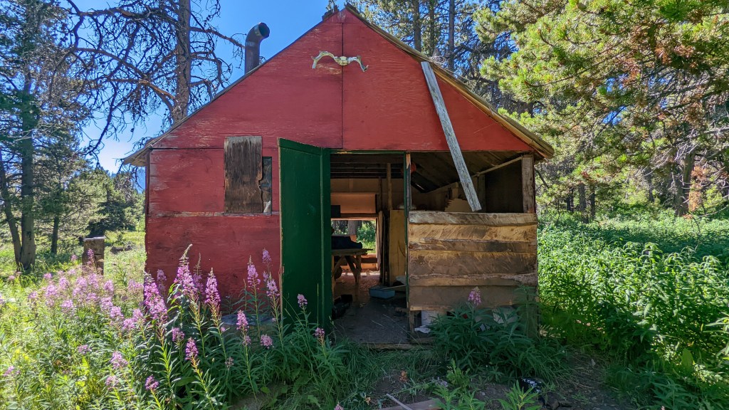


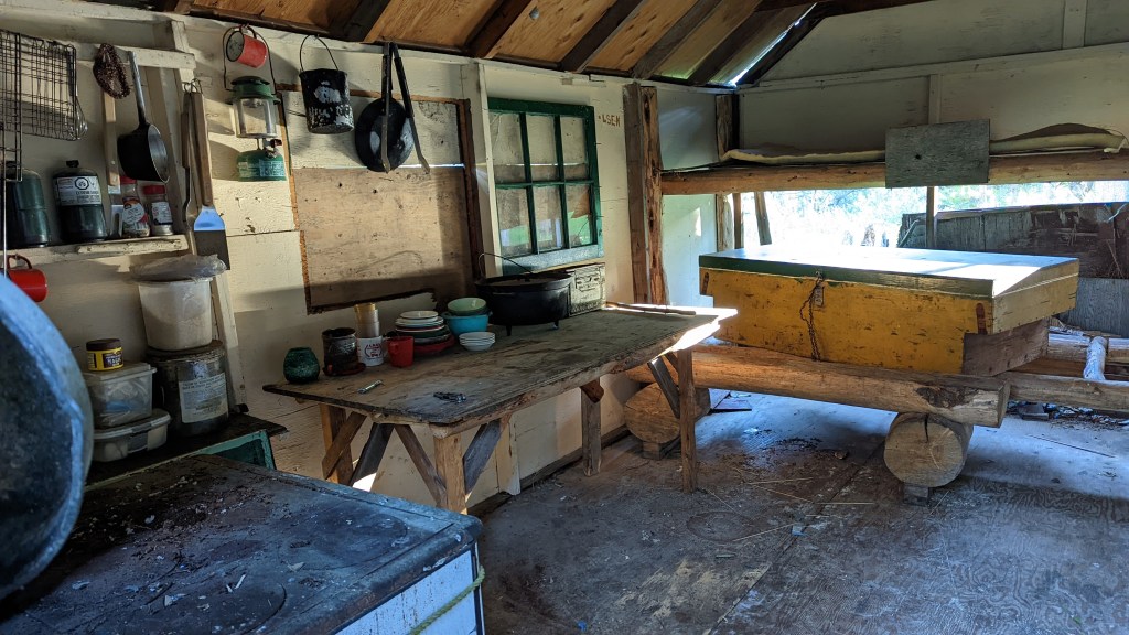
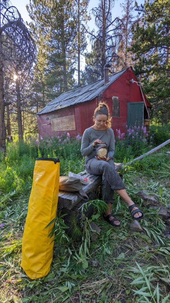

When we were getting a bit hangry we walked back to the cabin. I cleaned the insides and surrounding area up a bit, tidied, made dinner, and photographed bugs. The stream right beside us was a great water source and even had a cute wooden spout. Trevor “pretended” to sleep inside the cabin on the top buck, and we went to bed by 8pm. We are elderly.
Friday
Full moon and cool temps meant only one noctuid moth in the net in the morning, waaaa waaa waaaaa. Oh well.
After saying goodbye to the little cabin, we were out of camp around 6:15am. We started uphill past the cabin’s creek and a hunter’s bear hang, on the way seeing pieces of the trail occasionally and found it and followed it near the top. The bushwhack wasn’t bad, or perhaps Trevor is just that good about navigating through the brush. So once again we were confused by the folks we met on the road who said it they went halfway up and turned around in frustration.


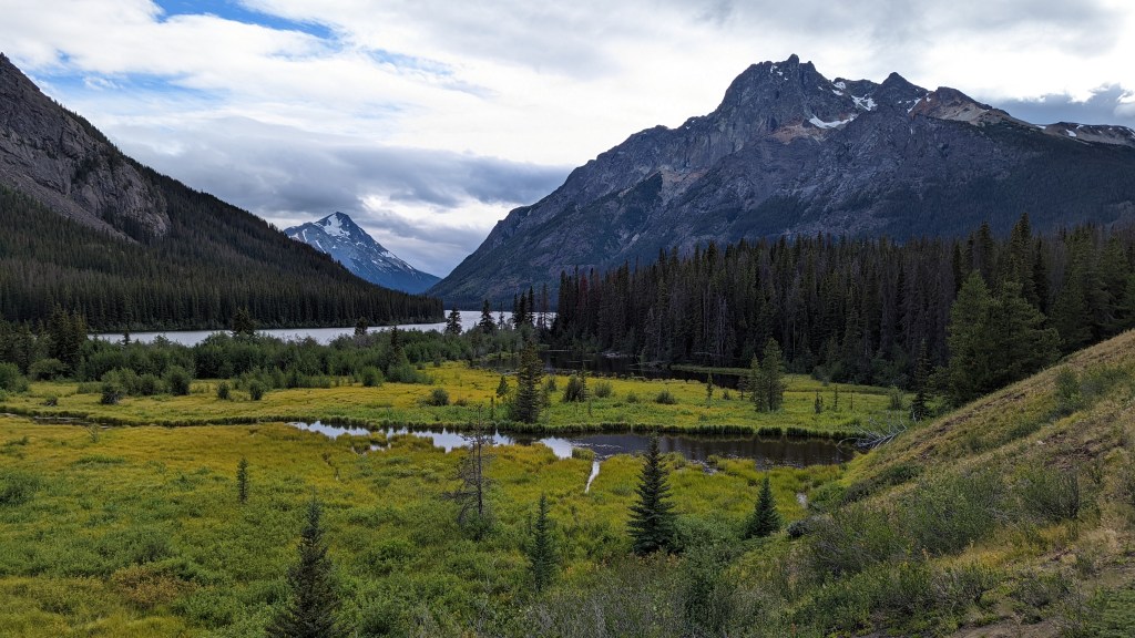
In about 45 mins we made it to the alpine meadows which weren’t too steep, as previously imagined, and as they appeared from the valley’s bottom. Perhaps the actual trail started near Spectrum creek but the washout made the trail disappear. We can confirm that the trail stays on the right side of Spectrum creek (the same side as the cabin); the only trail point we confirmed was at 51.13526, -123.82325.
We stayed just above the gorge and headed towards the pass, eventually crossing over to reach a few snow patches to hunt for bugs. We could see a grizzly far above us who kept moving along, so no worries. Found some good bugs on the snow, despite the snow being very clean it wasn’t bountiful with bugs, so onwards to the pass!
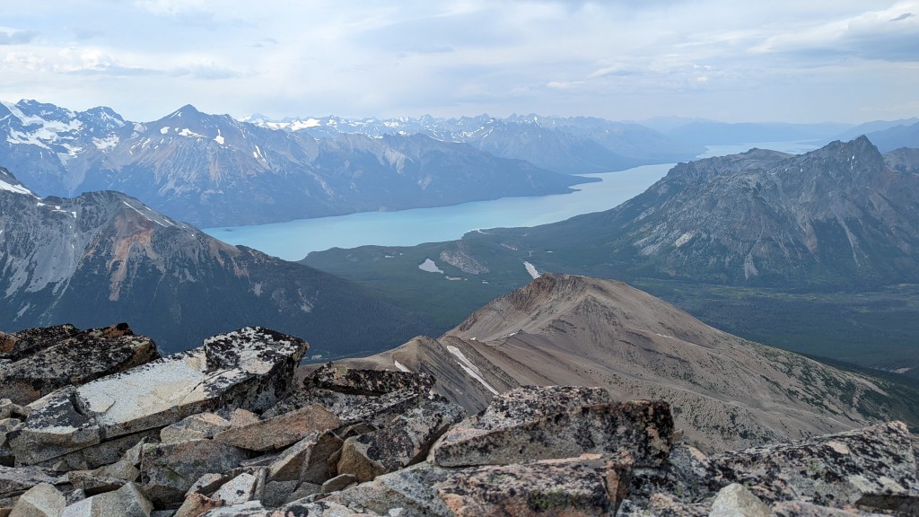
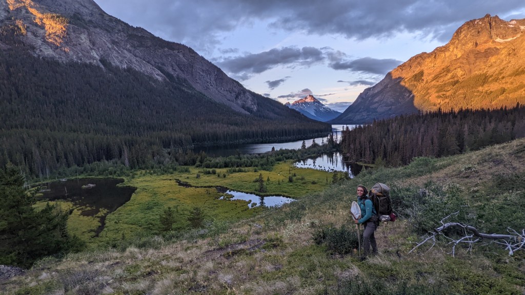
We dropped our bags near the small blue pond at the pass and headed towards West Rhino. The climb was easy enough, but the clouds were coming in. So we semi-blitzed towards the peak where we had incredible views, enjoying the 360-degree views. The clouds were still ominous, so we headed down to botanize a small bench at the flat portion below the peak.

The clouds were getting darker, so we headed down the other side of the pass. We stayed near the creek, which meant crisscrossing back and forth a few times: the wet feet saga continues. We were looking for a good spot to camp that gave us wind protection, but in the subalpine, it’s kinda tough. However, we found a spot with a creek nearby that came straight out of the hillside. It appeared to be a very old camp with some charred wood and tree cuts. Trevor was determined to make a bed essentially IN the trees, so he widened a small spot in the trees using a stick and rock and breaking many dead branches. Our tent just fit. A recent grizzly bear had gone nuts nearby and tore up a huge area of dirt in search of a marmot. The loose dirt came in handy in creating a bit of a dirt bench for our tent to sit on. Only one door for access, but we did have a “back alley” aka a small path between the trees, which was probably an animal trail.
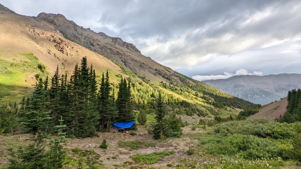
We thought the weather was going to get nasty overnight so I threw up the tarp as well. We had a hell of a time getting our bear bag hang but did so successfully in the end, also hanging the moth light up in the same area, in a small meadow from our tent. Got to bed later than usual so we slept in the next day.
Saturday
Got a later start than normal because Trevor had to photograph the previous day’s bugs and the plethora of moths we got overnight. As I made breakfast and got our day bags ready the clouds kept rollin’ in. This was somewhat expected, as our inReach has an incredible weather report, which we requested at least once a day.
Knowing it might rain we thought we’d stay close by and check out a nearby ridge. The weather was holding so we just continued on the ridge, botanizing. It was a tough go, we took a small break before hitting the last part of the climb before the pass. Shale, shale, shale. Besides a small snow patch at the top, the trek consisted of deep slippy shale. Once at the summit, and after a short break, we headed for Spectrum peak. It was cool and windy, with the occasional spitting of rain. The last full climb before the peak area was nasty, loose shale, and tough on our sore leg muscles.


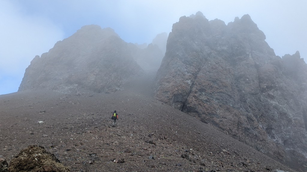
The whole day my foot had been bothering me, just below my toes on the upper part of my foot felt sprained. I didn’t think I could make it to the top, but I switched sides of the gulley which made it easier. The top was cold, windy, and generally nasty but there were small sections of sun. We snacked and Trevor hunted for plants and bugs while I tried to rest my foot. We didn’t make it to the very top due to the weather and it was a scramble-ish scenario.


The reason we even make the effort to go up to these peaks is to look for species that reside on mountain tops or are attracted to high places, like hill-topping insects. One genera in particular that Trevor has quite the knack for, or at least the passion to hunt for is Genus Terralonus. This 5 mm long dude. . . dudette was found near Spectrum peak under a rock. BUT this genus can also be found on the beaches of California! What a wide range of habitat types! Sooo cool!
We eventually headed down towards the pass and onto a small second peak, if you can even call it that. It was the top of the ridge where the pass bends, so in theory, it could have great views, but it was so windy and cold we just wanted to head down. We went through a small gully, and then down a sandy slope that was quite steep. You wouldn’t want to head up this way, as you’d sink down as far you step up. Once back to camp, we took a rare hour to chill in the tent before starting on an early dinner and bug photography. We ate dinner overlooking the creek and reminisced about our “wedding” party, that took place a few days before this trip.

After dinner, Trevor went down the creek afterward while I tidied up camp and wrote the trip long while stretching. Bear hang got set up, as well as the moth light, and then to bed for some reading before what we believe to be a savage day in the forest tomorrow.
Sunday
Packed up camp, and headed out, crossing the creek onto the other side of the valley, as we knew that’s the side of the trail. The trail wasn’t easy to follow here, as meadows filled in the trails, and cuts were few and far between. At one point we stopped to empty our sweep net, which was right before a small wet meadow. When we set out we went straight through the meadow but should have stayed along the right edge of the trail. So that lead to at least an hour detour of realizing we were following a wildlife trail, so we turned around back to the meadow. Oh well I gathered a few interesting fungal observations during the detour.

There is a small tree with a pink ribbon about 7 feet in the air that eventually lead us to the trail, and shortly after to the creek crossing, which we did around 8:10, located at 51.17157, -123.86364.
We crossed the north fork of spectrum creek around 9am, but had trouble finding the trail after losing it earlier. So Trevor went up the hillside and eventually found cuts. We had come too low at some point, so we then realized we were following a bear trail. To our credit, someone did cut out some low-hanging limbs at some point, so we weren’t too mentally off. Oh well, we were back on track, which was at 51.18258, -123.86985.

At this point, the trail stays high and was generally great! A narrow highway! We stopped by a waterfall along the trail for bugs and bryophytes. At this waterfall, Trevor turned over a few rocks and found multiple Amphizoa insolens, a member of the Trout Stream Beetle family. On iNat there are only 6 observations, and BugGuide only 5. So even though this beetle can be found along the west coast, and east towards AB, MT, ID, WY, and NV it’s seldom reported (BugGuide). They live under the water, adhering to stones

The clouds were burning off, and a blue sky was appearing! Yahoo! About a kilometer from Dorothy Lake the trail was difficult to follow. Lots of windfall/bug kill made it difficult to traverse, so looking out for cuts and blazes was essential.
Around 2:45pm we crossed the outflow of Dorothy Lake, after going through quite the moose swamp. I guess the whole outflow is swampy because we were not sure why it didn’t stay in the trees, so we felt like we were walking too far away from the lake. After the wet crossing we found a trail, but nothing more than a wildlife trail. The trail to rainbow? Maybe!? We found the actual trail but the beetle kill and windfall were so bad we lost it often. The trail did stay near the edge of the water, but it was sure slow going.
Around halfway around the lake we found an old campsite with a canoe that had seen better days, Trevor tested it out, but it took on water quickly. Both our eyes and noses told us there was a lot of bear activity around, so we wanted to move along.

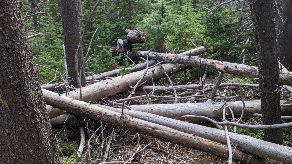
Continuing on the fallen log-filled trail we found more fallen trees and more headaches. Occasionally we’d find evidence of humans, a cattle fence, and a few old camps. We looked for blazes, but cut logs were the main helpful identifier that we were on the trail. We eventually gave up entirely and tested out walking in the water, For the next roughly 0.75km we walked IN the water, along the shore. The wind was up, so the waves crashed against the shoreline as we slogged through the knee-deep water. The water was cool but not cold, but it felt nice to be moving at a consistent pace. We walked all the way to the end of the lake, then through a ridge of trees and swamp, and into the beaver swamp. Total moose and beaver paradise. It’s a good place to observe any potential sedges or grasses that love the swamp life.
Finally, we made it across the small swamp and into the steep meadow, where we took off our packs, took some photos, and Trevor scouted for a camping spot which we found on the east side of the lake, right along the trail. Our camp spot was basically the only flat spot around, we were pooped and not interested in looking much further.
We heard moose stopping around in the evening, but never saw him, as well as a beaver slap in the morning. Besides our wildlife neighbors, it was a very quiet spot, especially when compared to our previous camps which all had the sound of a river or creek nearby in the background din.
Monday
Monday morning we were up and out by 6:15am. The sun was just coming over the ridge and already illuminating lots of Mt. Goddard as we headed out, gorgeous! We were anxious to know if the trail had really been cut out, and it was! Hallelujah!! BUT the trail was still easy to lose at some parts, we had to be diligent, looking for blazes and cuts regularly. In grassy areas or through marshes/swamps it can be tricky to relocate at times, but not difficult for anyone with previous bushwacking/off-trail/cross-country experience.

Eventually, we stumbled upon the Yohetta cabin, and what a glorious place! We spent about an hour there, admiring the cabin, and the lake, and using our solar panels to charge our devices. It’s a rare event for us to just sit around and take in the area.

The trail was pretty decent after the cabin, a few spots with a windfall, one in the particular spot left us scrambling along the hillside for a moment. Eventually, the trail, that goes along the lake leads to another cabin, a rat palace of sorts. We snacked here and left around 11:40am.


Above is Bombus occidentalis ssp. occidentalis, a vulnerable/critically imperiled bumblebee that I found dead along the trail on the way out of Yohetta Valley.
From COSEWIC’s 2014 Assessment and Status Report, “It has among the highest parasite loads (particularly the microsporidian Nosema bombi) of any bumble bee in North America. Ongoing threats to the species, particularly within the southern portions of its range, include pathogen spillover from commercially managed bumble bee colonies, increasingly intensive agricultural and other land use practices, pesticide use (including neonicotinoid compounds), and habitat change.”
At this point, the trail became an ATV track, which had only a few fallen trees since it was cut out, which was obviously recently. Around 3:45pm we made it to the road and continued toward Tzucha lake. Yipppeee do daaaa! “Civilization!”
We found that the road around the lake had a small opening, and down below was a campsite, not great, and somewhat forgotten, but still great. So we popped up the tent, Trevor took a strategic bath in the lake, and we took a wee nap. When I was about to get dinner going, three folks on a side-by-side/commander stopped by. They were the owners of the cabin we could see down Tzucha lake, and one was the owner of the amazing cabin at Yohetta, it was great to meet you, Jack! We chatted about outfitting, the Yohetta cabin, and the road conditions, and they headed home.
When sorting out dinner a brown-colored black bear and two cubs got very close, within roughly 30 feet, luckily Trevor heard them and our shouting got them flying out of there. How could they not have heard us?
We ate our final backpacking dinner and reminisced about the trip. We were about to do after-dinner chores when Milo and Crystal, the couple who had joined Jack earlier came back and offered a ride to our car. Of course!! Trevor went with them while I stayed back and cleaned up. They all came back successfully with our car, we had a nice chat, and took a photo for the memories. Wonderful folks, but they said it was all Jack’s idea to offer us a ride.
We learned that the gate at 3-ish kilometers in is often closed, not just for hunting. So any future trips will definitely involve a backup plan or asking the folks at the welcome center in Nemaiah.
The evening finished with Trevor photographing bugs, I semi-packed the car and we said goodnight well before 10pm.
Tuesday
Ahhhh what a nice feeling to wake up knowing we didn’t need to walk 11km. So we packed up the remaining stuff and took the 2hour ish drive back to the main road. The return trip home was uneventful, and by 3:30pm we were back on the farm in the Pemberton Valley.
Notable Bugs


Here are two interesting beetles, on the left is a Click beetle (Elateridae) found under rocks near stream, and on the right is a False Darkling Beetle, found walking on a fallen log. Both species have very few observations on iNaturalist.

Left-most bug: Geocoris punctipes. This little brownie was found running around alpine sandy cut banks above a stream. It’s the first observation in BC on iNaturalist, the rest were observed in the lower half of the US. On GBIF its range continues south into South America. Huge range expansion? Possibly! It’s a member of Family Geocoridae, also known as Big-eyed Bugs. Hehe, just look at those big peepers!
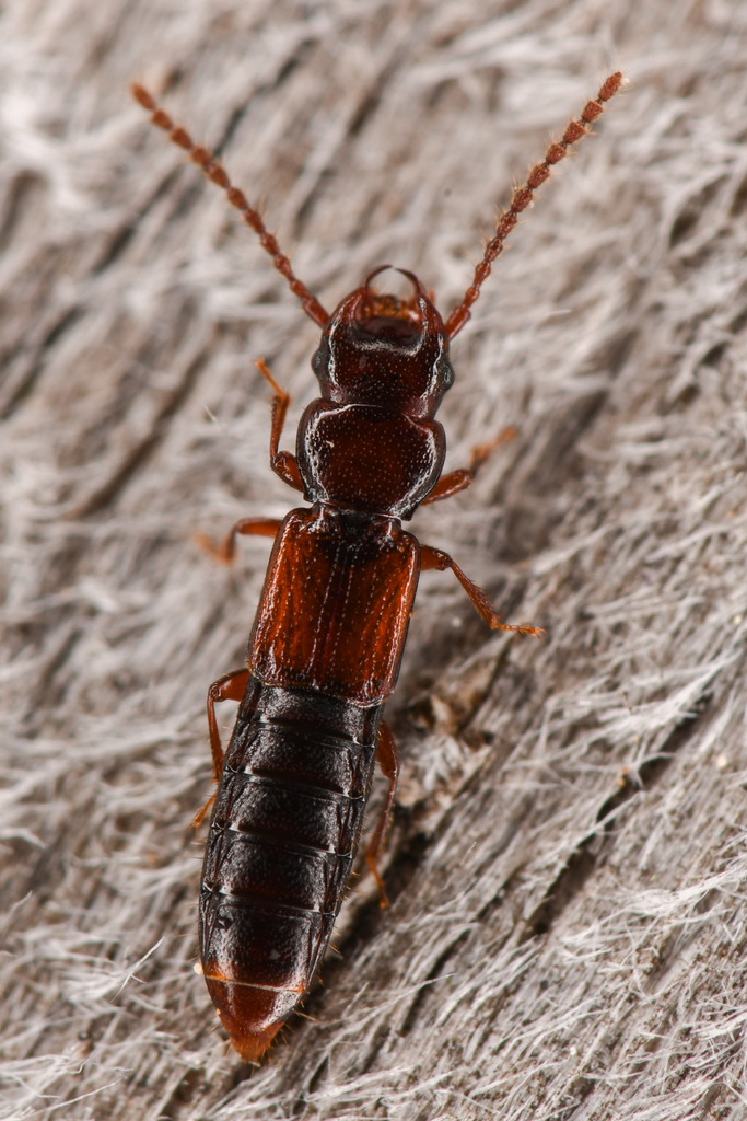
Center bug: Siagonium stacesmithi. This fancy man was found at the base of freshly killed lodgepole pine, under the bark. This 5mm-ish beetle is one of four on iNaturalist, and will eventually join the one other observation on GBIF which is from New Brunswick in 1957.
One month later:
Wow, this trip was one for the books. We collectively agreed this might have been our favorite backpacking trip ever, or at least in the running against our first trip to Big Creek Provincial Park in the South Chilcotin Mountains.
For some backpacking trips we try and keep our route or adventure specifics hush-hush to prevent others from destroying it. However, this loop feels like it needs advertising! Truly only folks interested in the full slog, and effort to even get to the trailhead will do this loop. So if you are interested at all in this trip, I highly recommend it. The views are stunning, the trail (when clear and follow-able) is efficient, adorable cabins to fawn over, there are many side trips possible, ample water, even in late summer, and has enough headaches to make the trip feel ooo so rewarding when finished. So many memory-making opportunities on this loop.
For anyone interested in this loop:
–The loop would be best done with a shuttle car, to avoid potentially walking a long way either on the first day of the loop, or last
–Check with the Welcome center, or call ahead to find out the status of the gate, and potentially the status of the trails, and gas up there.
–Grizzlies are very common in the area but are spooked easily. So, be bear smart, and make noises/”hey bears” often.
– None of the cabins are sleep worthy or unlocked. The cabin at the east end of Yohetta is private.
–Tzucha lake has a good campsite, at the “T” turn left for a few hundred yards
–The ladies at the welcome center said that the Dorothy Lake portion will hopefully be cut out, perhaps within the next few years, depending on bids.
–Big thanks to this Club Tread post whose log we downloaded on my phone, and referenced a few times throughout the trip. https://forums.clubtread.com/27-british-columbia/40815-tchaikazan-yohetta-loop-august-2011-a.html


Spectacular trail log with other-worldly photography. Thank goodness for top quality audio visual equipment and skilled users. A real pleasure to read and follow along.
LikeLike
Thank you so much! Really appreciate the kind words, and glad you enjoyed the read!
LikeLike
Read this on a chilly winter night in Ontario, and I really enojoyed it. The details, down to geolocation, are great. I could see the places on the map and place the loop in context. Highly unlikely I will ever make it there, I am over 60 and have too many things to sort out before I could afford a trip to BC. But your blog took me there, I saw the place with your eyes and for that I am grateful. Many blessings.
R
LikeLike
Wow R, I am so very glad you found my post for a lovely evening reading event. Knowing you were able to follow the route from afar is so wonderful to hear. I hope you can make it out one day, but if not at least this and other well written blogs from others from across from BC may quell that desire. Much cheaper option too hehe!
LikeLike