Insane views, campfires in the rain, just missing a puma with cubs, beautiful native flora, and some very sore feet were all components of this four day trip in the South Chilcotin Mountain Provincial Park.
Acknowledging this trip took on the traditional lands of Tsilhqot’in, St’at’imc, and Secwepemc Nations.
For the American July 4th 2020 holiday we spent it in the Canadian wilderness. No better activity, in my opinion. This was my first backpacking trip in the South Chilcotin Mountains Provincial Park only having a day trip tease recently prior to this trip. But it wasn’t my last. We took three more backpacking trips within this park and the adjacent Big Creek PP over the following two months. It’s a pretty special place, and if you’ve been lucky enough to spend time within the park you’ll understand our obsession.
This park is quickly rising in popularity for mountain bikers, hiking, and still holds onto some of the horsepacking outfitters that used to dominate the recreation scene. Livestock also used to dot the hillsides, with both cattle and sheep herded through and cowboys living out of the cabins which still stand. One of those cowboy/outfitters was the famous Chilco Choate, and reading one of his books really brought the area alive with history.
I used to sit at the kitchen table listening to stories of horse and bike trips through the meadows, rat-infested cabins, summiting passes, and time spent around the lakes of my hub’s family. Now I finally got to experience those places myself. Yahoo! After this trip I finally could say I slept under the “roof” at the Trigger Lake cabin, visited Warner Lake, hiked up to Deer Pass, hiked the length Sheba Ridge, walked the length of Spruce Lake, and camped in the meadows of Cowboy Camp.
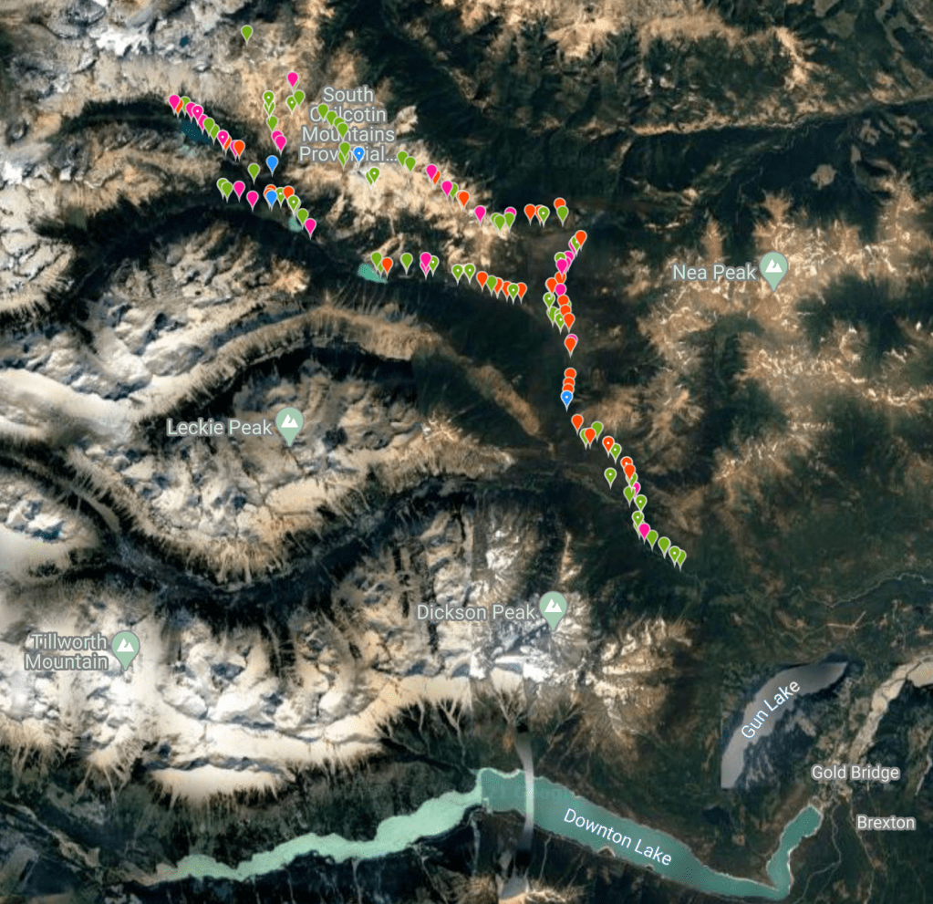
From the iNaturalist map you can see our general route. Observing plants, fungi, and wildlife as we travel means we get this really neat map outlining our route of what we saw where. This was also a trip where we purposely documented as many species as we could for the BC Parks iNaturalist Project. Over our multiple trips to the park in the summer of 2020 we documented 335 species with 899 total uploaded observations.
First Day on the Trail, Jewel Bridge to Trigger Lake
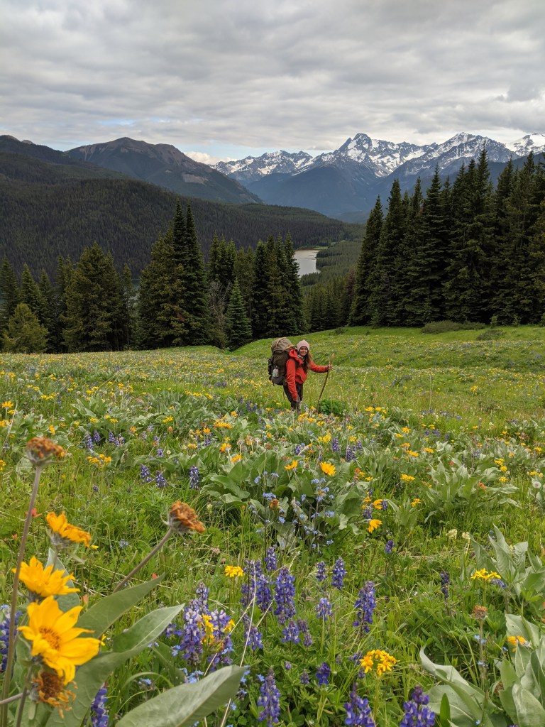
We left for the park at 4:30am from Pemberton Meadows, over the Hurley FSR to the Jewel Bridge trailhead where we left the car at just before 7:00 am. Since we had visited the Gun Creek Meadows a week or so prior when the wildflowers were blooming beautifully, we took the lower Gun Creek Trail towards Hummingbird Lake.
Moments of rest throughout the day or any backpacking day with Mr. Trevor is always limited in quantity and/or extremely brief. But we did take a moment to iNat the lakeside and I enjoyed the view for a minute or two. But we didn’t rest long, or even have time to enjoy the new picnic benches and outhouse because it started RAINING! GAH!
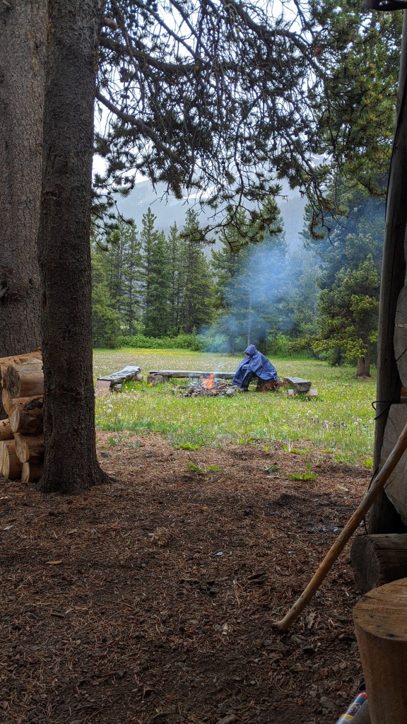
Rain while backpacking isn’t super fun, and living in BC it’s just inevitable, but it basically rained on and off for the next two days. Poopy. Oh well. We ended up camping under the overhang at the Trigger Lake Cabin, where Trevor slept inside as teen. The cabin or and surrounding tents didn’t have signs it was being used by outfitters, but it was still early in the season. But we did find out in a future trip that indeed it wasn’t being used this season. So Trevor got a fire going in the rain *clap clap clap,* to warm us up while I got dinner going. Backpack pantry for lyfe bebe!


Second day on the Trail, A Rainy Day in the Gun Creek Valley
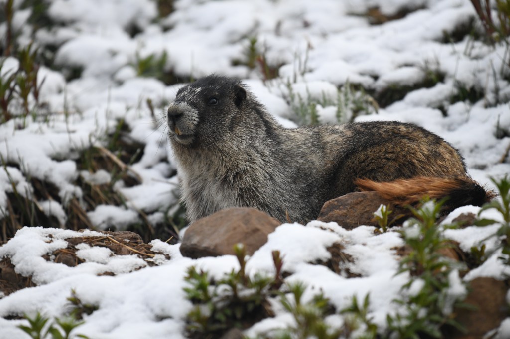
While we had plans to summit Deer Pass the weather wasn’t looking too good, so the second day/first full day on the trail was spent in three different spots in the valley. First was exploring up Gun Creek. Finding the trail was the hardest part, and although it contained a lot of windfall it followed the creek closely at times and at other points bordered swampy areas. After that little morning excursion, we hiked up to Warner Lake where we saw mountain goats, heard the whistlings of marmots, and explored the end of the lake. Nasty looking rain clouds were heading towards Trigger Lake, and we didn’t really want to be on the exposed trail if lighting were to vaporize. Once back around camp we hung out under the overhang for a bit, made another fire, but we aren’t too good about sitting around. So we donned on our crappy ponchos and explored the edge of Trigger Lake for interesting plants.

Conifer Baby 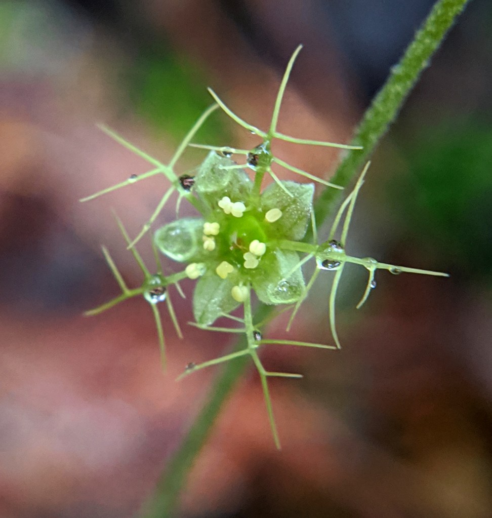
Naked Bishop’s Cap 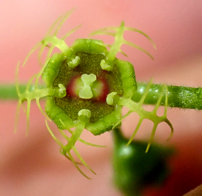
Alpine Mitrewort 
Northern Cinquefoil 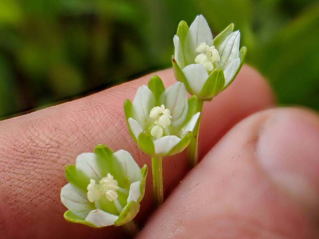
Kotzebue’s Grass-of-Parnassus 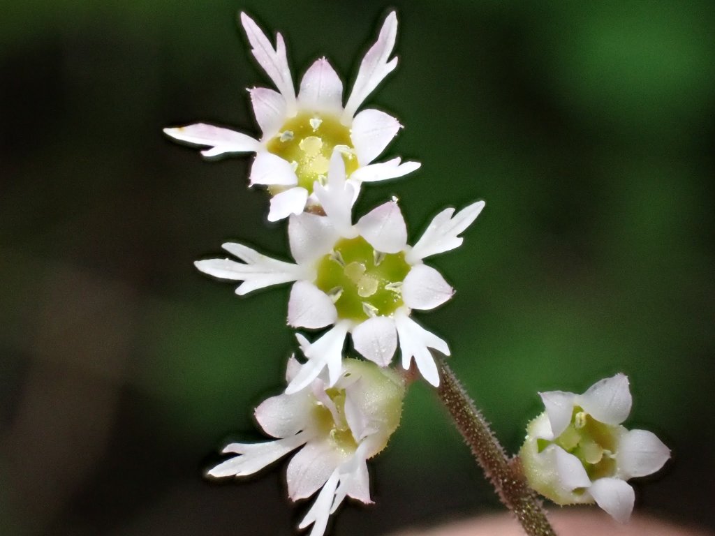
Pacific Bishop’s-Cap
Kotzebue’s grass of Parnassus (left side bottom row), a beautiful little white flower baby was observed at the north end of Trigger Lake. We only observed this flower at this location the whole summer! Only a single flower perches confidently at the top of the glabrous stem. The picture shows three flowers, but that’s us grasping multiple for a picture. It flourishes on wetter areas such as cliffs, and slopes in lower elevations at its higher latitudes, and alpine habitats in lower latitudes.
While we’d seen a few folks on the hike in on the previous day we met four young backpacking bros on our way back to camp. They attempted to get up to Deer Pass but turned around after a mountain lion and cubs blocked their way. Apparently, she wasn’t budging. For us that would be a dream to witness with the utmost respect for the animal. So they trekked all the way back down to find camp near Trigger Lake. I felt bad that we basically claimed the only decent rain cover, as the designating camping site didn’t even have much tree coverage, but it did have newly installed bear bins and an outhouse. It was a rainy rest of the evening and night.
Day Three, Deer Pass and across Sheba Ridge to Cowboy Camp
Well of course we were on high alert the next day as we hiked up the steep-ish trail towards Deer Pass. THE VIEWS! Oh my goodness, the views you get after coming out of the treeline is MAGNIFICENT! Breathtaking. Even with sub-optimal conditions, this area is still one of my favorite trail sections of any trip I’ve done, ever. I would have been hootin’ and hollerin’ with joyous exclamations but we had a puma to spot. Unfortunately, we didn’t see her. But seeing a large buck traverse through the meadows below the trail towards Warner Lake was spectacular. Oh my goodness, I’m just tearing up thinking about the hike towards the pass’s summit. I’d gladly spend all day up there.

Trevor enjoying the view for a minute.
We had confirmed Sheba ridge was snow-free with a local pilot (thanks Dave) but the recent rain meant we hit snow. Fresh snow. It was like walking into another planet, so silent, so still, so beautiful. It wasn’t too deep, but deep enough to set in quite a lot of anxiety about starting the Sheba ridge portion, which to our knowledge had minimal to no trail. With a good blanket of half a foot of snow in some sections as we began traversing the ridge I was getting really nervous. After taking a very non-direct route towards Sheba Mountain we spotted the trail from afar, and I breathed a sigh of relief. Once we reached the trail, which was nothing more than a goat trail, the snow dissipated. Thank goodness!

Just a little dusting. . . 
More snow accumulated near the summit 
At Deer Pass summit. Chilly!
We had read a trip report from a gentleman that did the whole ridge over two days, and we chose to do it all in one. The mileage was on the high end, but doable for two ding dongs with a lot of determination and passion for finding plants in hard to reach places.
So once on the trail and armed with a general route Trevor had plotted before we trekked along, we stopped frequently to observe and document flowers, lichens, and to pause for the odd photo op. The views again were SPECTACULAR! We could see down into Trigger and Hummingbird Lake, and eventually, both valleys containing Tyaughton Creek and Gun creek at the same time. Unfortunately, I can’t add video into these posts, but just know I was freaking out with happiness. As a small disclaimer, this trail is not the easiest to navigate, but once you’ve rounded Mt. Sheba the walking is pretty easy, and straightforward.

Lookin out at Warner Lake in the background, near Mt. Sheba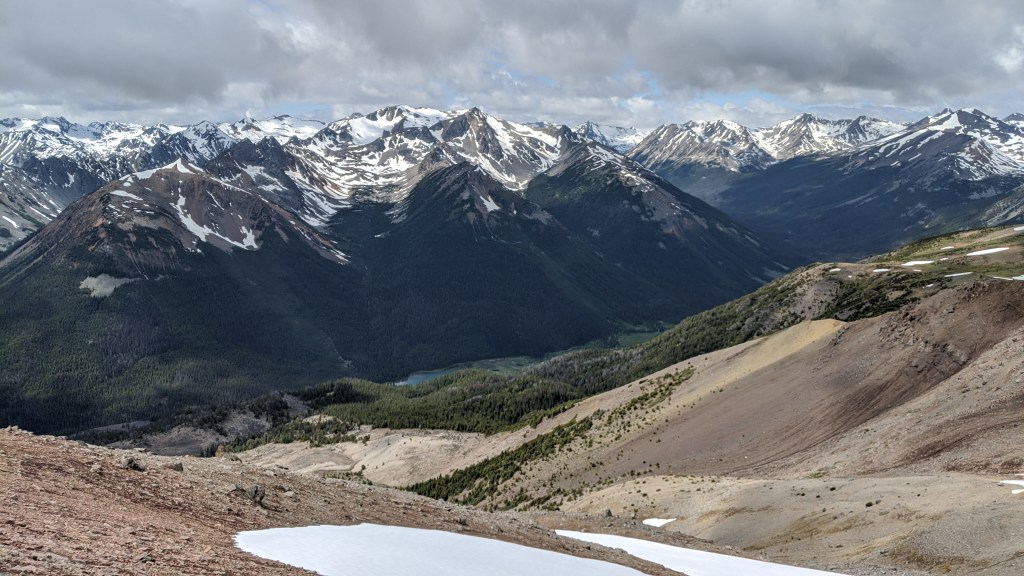
Hummingbird Lake is to the left, and Sheba Mtn to the right.
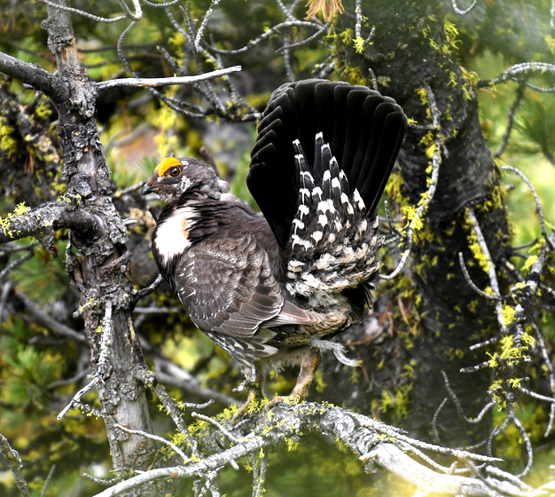
We had lovely surprise while on the ridge, Bighorn Sheep! Along with this small group we saw, below is other wildlife we saw. No grizzlies, but on the next trip we sure did! You’ll have to stay tuned for that trip log to hear about a very special encounter.


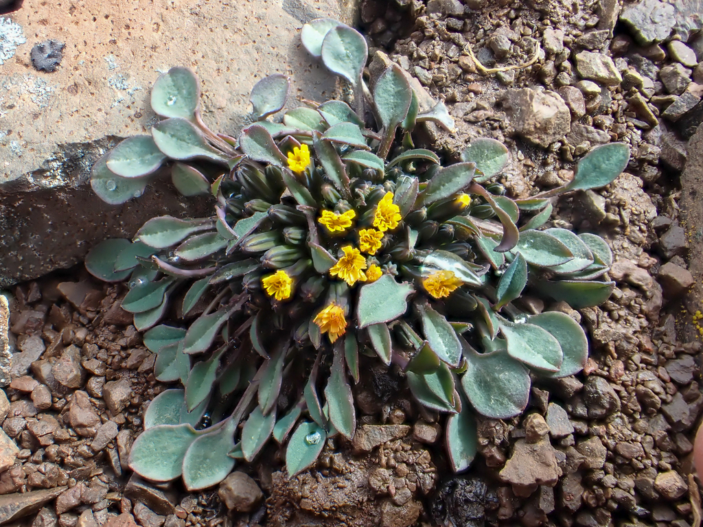
While traversing Sheba Ridge, the glorious Dwarf Alpine Hawk’s-Beard (pictured below) would dot our path. The bright yellow flowers really gave a punch of color to the brown and green-hued landscape. There can be up to 80 flower heads on one plant clump, Wowza! While we know this plant currently as Crepis nana, apparently a taxon change is coming (thanks for the heads up iNat), and it will be known as Askellia pygmaea. Taxon changes can occur for many reasons, but it sure makes it hard to remember scientific names when they change!
The descent down into Spruce Lake was probably the worst, most nerve-wracking, swearing-induced part of the whole trip. I do not like scree slopes. Not one IOTA! There are two known routes to descend down towards the open heart trail, and we didn’t take the longer one that loops towards the Gun Ck meadows. So while I was tightening my boots and backpack crazy man Trevor had already bombed down the steep scree slope. F*$K! There was no choice but to follow. I did, but not without constant grumbling. At one point I fell on my butt and ripped many small holes in my brand new Gore Tex rain pants that I’d been living in all weekend. Nothing a little gear tape can’t fix.

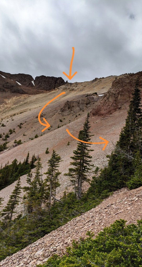

Ooooof I was happy when we reached the Open Heart trail. Solid-ish ground FINALLY! Now the descent down to Spruce Lake. The trail is quite steep and hard-packed. I was surprised to see signs of horses because after a long day my knees were feeling it, and a steep downhill was not super fun. But we made it out into the beautiful meadows at the north end of Spruce Lake. Ah! Gorgeous! Once we reached the lake our plan was to camp at Cowboy Camp, which is all the way at the other end of Spruce. At this point, our feet were DONE! Anyone that’s done a long backpacking trip and experienced feet pain at the end of the day knows what I’m talking about. It’s not just the tired kind of pain, I’m talking about the kind of fatigue that won’t escape your mind causing you to start singing in delirium about said pain. Twenty-two miles will do that to your paws.
Well being from potato farmers, and having multiple childhood memories of passing the “Potato Patch” Trevor was excited to show me the spot. It was indeed adorable. The cabin is still semi-standing, and it was a nice landmark to know that we had made progress around the lake, even though it felt endless.
Well the fun wasn’t over yet. Why not make a very long day even longer? Perhaps our exhaustion caused our brains to malfunction and we totally took the wrong trail TWICE! GAHHHH! I was so hangry and tired at this point, to which I still remember the pain writing this seven months later. We took an old trail towards Cowboy camp, not the current one because we were going off of Trevor’s childhood memory. We made it out into the top of the Gun Creek Meadows and found a great spot to plop our bags down. Before deciding on a camping spot we explored the now derelict Cowboy Camp. Trevor camped in its hay day multiple horse trips as a kid, and we thought it would still be semi set up. But sadly it wasn’t. There was a horse outfitter with four or five horses grazing in the meadow as the guests watched the sunset across the meadow. What a scene! Just gorgeous!
Almost at Spruce Lake (in the background)! 
Heading towards the Gun Ck meadows 
Bug hunting in the meadows 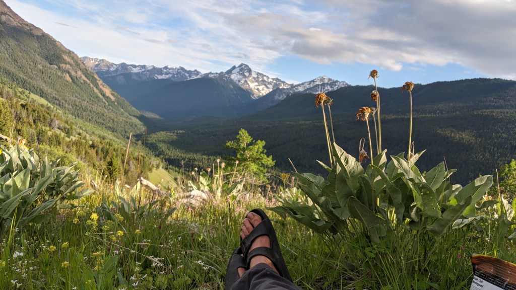
Time to rest the poor feet! 
Our last camp of the trip, looking down the meadows.
The final Day: Bugging the Lake & Meadows before Hiking out
We camped just below the trail, visited by a curious deer that came by a couple of times. We packed up in the morning and headed back to the Potato Patch where we stashed our bags and explored the edge of Spruce Lake and the meadows for interesting plants and insects before heading out back to our car. Below is a few of the fun bugs we found! Such cuties!

Striped Leafhopper 
Sonronius dahlbomi 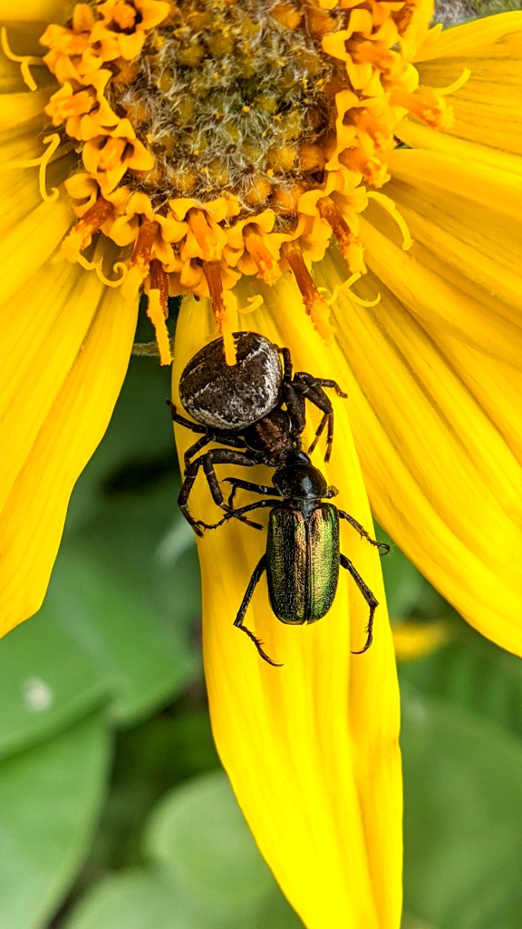
Crab Spider eating a beetle 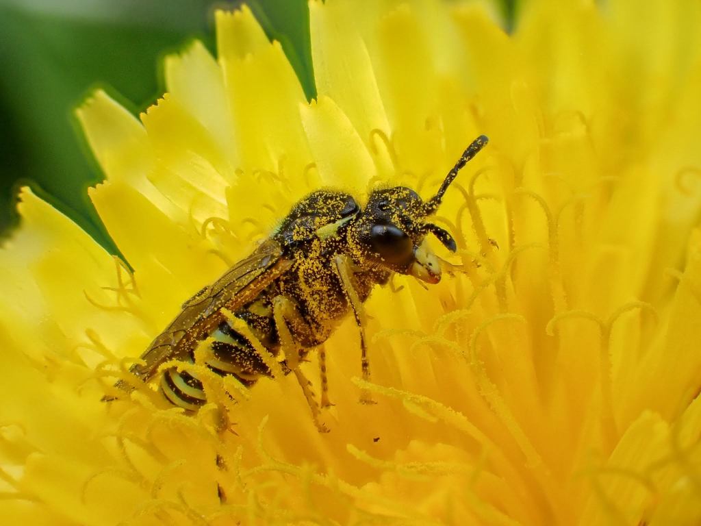
Genus Tenthredo
One last little plant highlight. We found this gem all over the park, and I just think it’s stunning. The One-flowered Wintergreen (Moneses uniflora) (pictured below) can definitely be spotted lining the trail Gun Creek Trail, especially in the beginning section. It has a single nodding flower on its erect stem, reaching about 3 to 10 cm in height. Smack dab in the middle of the flower is the female part, the pistil in a gorgeous light green color with a very large stigma-the terminal part for collecting pollen. Radiating from the pistil is the stamens, the male part of the flower which has orange tipped anthers and creamy white filaments. What a STUNNER! So photogenic too!


Hiking out we saw a lot more mountain bikers and our puma spotting friends, but never chatting long. But we did have an insightful conversation with a lovely older couple whose car was parked next to ours at the Jewel Bridge parking lot. While they were from the lower mainland they had explored every inch of the South Chilcotin area over decades, and still backpacking at their age! So inspirational! They insisted we visit another area of the park that’s often overlooked, which we did a few weeks later and it was incredible, another trip log to write up, so stay tuned.
It was a fantastic first backpacking trip in the Chilcotins. I’ll never forget the views from Deer Pass. I’ll eventually write up our other trips within the park, which had their own set of unique challenges, but this one felt fitting as a start. Below are a few of my observations that I wanted to include, but didn’t fit elsewhere.
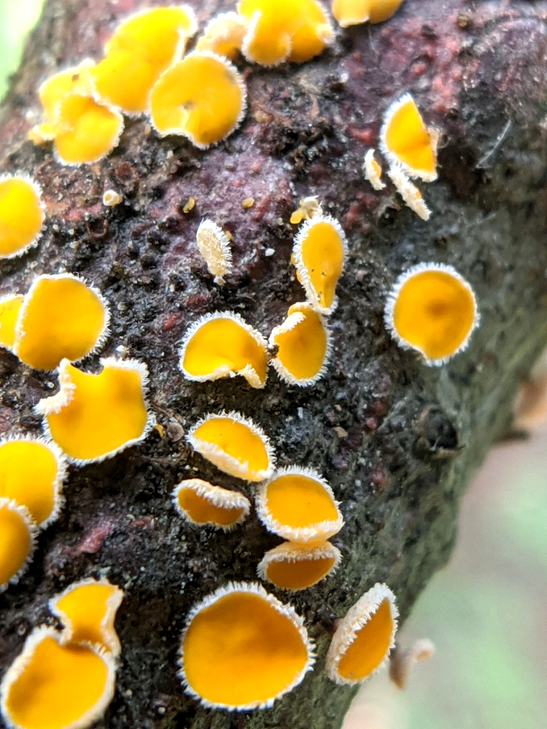
Genus Lachnellula 
Leafminer and a gall(?) 
Columbia Spotted Frog 
A Meadow Fly landed on my jacket!
Trip Log with Time Stamps:
- Thursday
- Left home at 4:30 ish
- Left the car at 6:55
- El dorado creek at 8:30
- Gun Creek, first bridge at 9:33
- Second bridge at 10:27
- Junction at 11:15
- 2:30 Hummingbird Lake, great facilities, wood, bear box outhouse, a couple of rain drops
- 3:55 Trigger lake
- 4:20 Trigger Lake Cabin
- Friday
- Made a fire in the morning
- At 7:00am we headed towards the Gun creek trail, had to bushwalk first then found the actual trail
- 11:15 made it to the far end of Warner Lake
- Saturday
- 5:30am We left camp
- 8:30am Made it to Deer Pass
- 3:30pm Reached Open Heart trail
- Sunday
- 6:55am We left camp to explore swamp
- 9:00am Returned to Potato Patch to grab our bags
- 12:10 Made it ot the junction with Gun ck trail
- 2:30 ReachedEl Dorado Creek
- 3:45 Reached Jewel Bridge, yahoo!
References & Links
Since there is pretty limited information online about this route, if you have any questions about exact points, please feel free to comment below! For some reason all my maps.me points have disappeared showing our exact route.
But one of the main references we used was this 2017 Club Tread post.
An overall background of the park can be read about here.
These posts may be helpful too:
Flower Information:
Happy Backpacking!

What an amazing trip! It brings back so many memories. Gorgeous country.
LikeLiked by 1 person